
Ashburn Neighbors by Block
An Ashburn block search has separate sources for parcel adjacency, ownership history, permitted work, community context, and historical material. The official block chain starts with the map and assessment record because both are keyed to a place. A voter record has a narrower legal path, and a community listing is not a membership roll. Read each source for the fact it can support. Parcel boundaries tell which land is adjacent. They do not identify everyone associated with a nearby address.
| Block source | Fact it can show | Access route |
|---|---|---|
| WebLogis adjoiner tools | Adjacent parcels, PINs, boundaries, parcel relationships, and map context | Free map: Show Parcel and Adjoiners or Find Adjoining Parcels |
| iasWorld assessment | Recorded owner or taxpayer, mailing and situs fields, subdivision, value, and characteristics | Free address, PIN, or ZIP search; weekly data update |
| Circuit Clerk deeds and plats | Transfers, legal descriptions, lot or block, covenants, easements, and parent or child parcel links | Free kiosks; remote index or images; copy channels |
| LandMARC and permit reports | Issued permit, project, address, PIN, date, and unit fields | Public portal and reports; reports from 2015 forward |
| Voter public-record route | Allowed registration fields for a registered voter | Registrar inspection under Title 24.2; exclusions apply |
| County community map | Community boundaries, selected association names, and private-street context | County interactive map and non-comprehensive list |
| Thomas Balch collections | Historical maps, newspapers, clubs, churches, photographs, and neighborhood files | Onsite non-circulating collection and reference request |
The iasWorld result is an assessment trail, not a complete household record. The Clerk’s records can test the ownership sequence, while a plat explains whether a nearby shape is a separate lot, a shared area, a condominium-related parcel, or a parent parcel. Note: Keep the source date with every map or assessment result because county layers are maintained on different schedules.
Ashburn Neighbors on WebLogis
Loudoun WebLogis supplies the geographic part of the block search. It accepts an address autocomplete choice, a PIN, or a map-tile search. After a parcel is located, its tools can show the parcel or tile, show the parcel and adjoiners, find adjoining parcels, or find parcels within a distance. The layer list includes land records, ZIP, addresses, roads, subdivisions, zoning, districts, schools, environmental information, safety, utilities, planning, and imagery. The interface can also print the selected map result.
Select the suggested address before pressing Locate on Map. The research inspection notes that pressing Enter before a selection can produce an error. Once the target parcel is visible, turn on parcel boundaries, labels, address points, and roads. That gives the block its spatial frame before any names or deed references are reviewed.
The WebLogis parcel and plat popup shows the fields available after a parcel is selected.
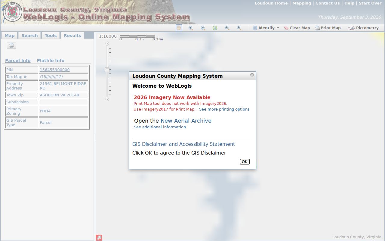
The map is not a survey. A boundary line, layer update, or popup value should be checked against the recorded plat or deed when the exact parcel relationship matters.
Map an Ashburn Neighbor Block
The parcel method moves outward from one verified address. It produces a dated adjacency record, not a directory of people. WebLogis can display a selected parcel and its adjoiners, while the companion assessment database supplies the property record for each PIN. A plat or deed is the next step only when the boundary, lot relationship, covenant, or ownership history needs more context.
- Enter the address in WebLogis, select the autocomplete result, and locate the target parcel.
- Turn on parcel boundaries, address points, roads, and any needed subdivision or district layer.
- Use Show Parcel and Adjoiners or Find Adjoining Parcels, then record each adjoining PIN, address, subdivision, and plat relationship.
- Open each PIN in the assessment database and preserve the recorded owner or taxpayer field separately from the situs and mailing fields.
- Inspect a plat or deed only for parcels that need a dated ownership or boundary explanation.
For a full named-street trail, use the Ashburn street directory route, which focuses on address-keyed records along a street rather than a small radius around one parcel.
Ashburn Neighbors and Assessments
The Loudoun assessment database can be searched by property address, 12-character PIN, tax-map number, ZIP, land-use code, and advanced criteria. The address screen accepts number, street name, street type, quadrant, and unit fields. The county documents a wildcard approach for street browsing and advises omitting a street suffix when needed. This makes it useful for checking one adjoining parcel at a time after the map produces the PINs.
Assessment fields can include the recorded owner or taxpayer, mailing and situs addresses, legal parcel description, subdivision, value, and characteristics. They cannot establish every person linked to the address. Follow an assessment result to the Clerk’s deed index when the question is when the interest changed hands or whether the legal description matches the map. A deed’s grantor and grantee identify a recorded transfer; they do not establish who was present on the date of search.
The Clerk’s land-record coverage reaches from 1757 to the present. Its free courthouse kiosks, remote index path, document-image options, historic PDF indexes, and counter, mail, or email copies offer different ways to verify a precise reference. That long record span can be useful for a parcel-history question, but it should not be compressed into a current block claim.
Ashburn Community Map Access
Loudoun’s Communities & Homeowners Associations page provides a Residential Communities Interactive Map and a selected, non-comprehensive association list. The county describes an association as an affiliation of property owners that enforces private covenants and may maintain private streets, common areas, pools, landscaping, or parking. The source is useful for community names, recorded-covenant context, and road-maintenance questions. It does not promise a directory of members.
| County community page | Use the map and selected list to identify a development or private-street context; do not infer a roster. |
|---|---|
| Recorded covenants | Request and inspect the filed instrument through the Circuit Clerk’s land records before relying on a rule or boundary. |
| Association materials | Public pages may offer board or meeting information, but a private member list is not a county resident record. |
| State community oversight | HOAs and condominium associations are regulated through DPOR’s Common Interest Community Board, while the Ombudsman can explain member rights and process. |
Most public streets are maintained by VDOT or a town, while private development streets are commonly maintained through an association. Recorded covenants need to be checked in land records, and the county says an unfiled covenant cannot be enforced. The community map is deliberately non-comprehensive, so it is a starting point rather than a definitive boundary source.
Ashburn Neighbors and Voter Records
Virginia’s public voter-record rules are narrower than an ordinary map search. Va. Code § 24.2-444 makes a limited field set available for inspection, including name, address, year of birth, gender, and applicable election districts, while excluding Social Security numbers, day and month of birth, agency of registration, and protected addresses. The Virginia Citizen Portal is for a person to check their own status, polling place, districts, absentee status, and voting history. A public list request or inspection follows the Department of Elections and registrar path.
A voter record can corroborate a registration fact within the allowed data. It cannot show every person associated with an address, voting choices, party preference, or a person’s present physical location. A non-match can reflect an unregistered person, a protected record, a different name format, or a changed registration. Virginia’s Address Confidentiality Program also shields actual addresses for eligible people who relocated to an unknown location.
Ashburn Block Lookup Sources
Official records and commercial lookup products answer different questions. The commercial category can combine property, marketing, directory, and public-record feeds, yet it may merge similar names, repeat an old address, confuse recorded owners with people present, or omit protected records. A map-and-record chain is stronger for the narrow question of parcel adjacency, although it also has clear limits.
| Source type | Useful for | Limit to keep visible |
|---|---|---|
| Official map, assessment, deed, and plat | Parcel boundaries, recorded land interests, legal descriptions, and dated transfers | Does not prove current presence or every household connection |
| Official voter-access route | Allowed registration facts under Virginia law | Restricted fields, protected addresses, and no full household list |
| Commercial neighbor-lookup category | A possible lead requiring independent confirmation | May be stale, incomplete, or conflate different people and addresses |
For accuracy, return to the office that keeps the record. Do not rely on an aggregated result where a parcel popup, Clerk document, or Registrar access rule gives a more direct answer.
Ashburn Block Privacy Limits
Some information should not be inferred from any block tool. Utilities, delivery records, school files, DMV information, private association membership lists, and protected-address details are not general public sources for block research. A county parcel map also cannot establish an individual’s day-to-day presence. Use public parcel and record information for civic curiosity, property history, and lawful personal research, not for surveillance.
Privacy and lawful use. Do not use an Ashburn map, list, or document to watch, pursue, harass, intimidate, or harm another person. Protected records and confidential addresses must remain protected.