
Ashburn Previous Residents Sources
A backward search separates property history from household history. The Loudoun assessment and map systems can anchor a current Ashburn address to a PIN, tax map, subdivision, and legal description. The Circuit Clerk’s land records then connect that parcel to recorded transfers. Library microfilm, census schedules, newspaper indexes, cemetery material, and vital or probate indexes supply family context that a deed alone cannot provide. A recorded owner is not automatically a person who was present at the address, so the source and its date should stay visible at every step.
| Source | Period documented | Where to use it | Trail it can support |
|---|---|---|---|
| Clerk land records | 1757 to present | Courthouse terminals, remote access, mail, counter, or email copy request | Transfers, grantors, grantees, and legal descriptions |
| Historic deed-index series | 1757–1812, 1813–1833, 1833–1857, 1857–1878, 1878–1893, 1893–1903 | Clerk historic records and deed-research resources | Earlier deed references and book research |
| Thomas Balch deed and will microfilm | Most actual documents through 1904 | Onsite local-history collection | Document images and published index leads |
| Federal census | Loudoun 1810–1930 at Thomas Balch | Onsite microfilm and library resources | Household composition in a census year |
| Local directory or reverse-directory lead | Exact Ashburn run not verified | Centennial Catalog and related catalogs | Possible address or name clue after a volume is confirmed |
| Issued permit reports | 2015 to present | Loudoun reports and LandMARC | Address, PIN, project, unit, and issue-date context |
Begin with the time period that is actually known. A recent address often starts with the assessor and WebLogis. A nineteenth-century farm, village, or courthouse-distance clue may start with the 1815 landowners reference, deeds, tax material, maps, and census. Note: A property record documents a recorded relationship to land, not a complete list of people who were there.
Ashburn Previous Residents by Deed
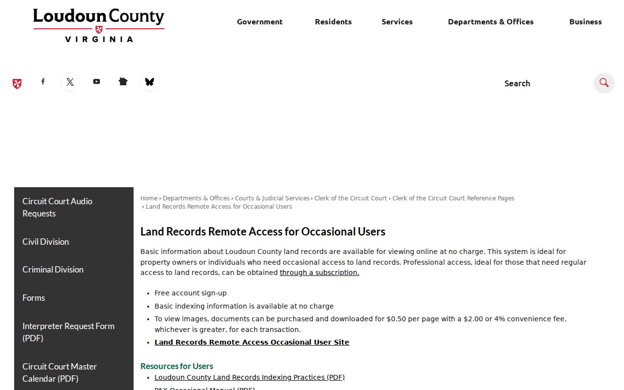
The Loudoun historic deed indexes divide the older material into the documented series shown in the table. For land records across the full 1757-to-present span, the Clerk provides courthouse terminals as well as remote, mail, in-person, and other copy channels. The remote service distinguishes free index access for occasional users from document-image access, which may involve individual-image purchases or an annual subscription. Courthouse kiosks are free. Historic PDF indexes can also supply a focused reference before a request is made.
Loudoun’s remote land-record service shows the access choices for the official index and images.
For copies, the Clerk’s historic-records information lists standard pages at $0.50 each, 11-by-17 pages at $1, and an additional $2 for certification. Fees and access choices can change, so confirm the current instructions before ordering. A narrow request with a book, page, instrument, or index reference is more likely to reach the right record than an open-ended request for a family history.
Ashburn Deed Chain Backward
Use the current address only to obtain a stable property key. Search the Loudoun real-property database by address, PIN, tax map, ZIP, land-use code, or advanced criteria, then confirm the parcel in WebLogis. The public assessment search is address- and parcel-focused; an owner-name search is not identified as a public feature. Write down the PIN, legal description, subdivision or lot, recorded owner, and the difference between situs and mailing address before moving to the Clerk’s index.
- Locate the address and save the PIN, tax map, legal description, and subdivision or lot details.
- Find the recorded owner’s purchase deed in the land-record index and copy the recording date and earlier instrument reference.
- Read the deed for the seller, who is the grantor, and search that seller as an earlier grantee.
- Repeat the transfer link backward, keeping every grantor, grantee, book or instrument reference, and legal-description change in order.
- Move to historic indexes, courthouse terminals, microfilm, or a focused copy request when the next record is outside the available remote path.
- Grantor and grantee
- The grantor transfers an interest in land; the grantee receives it in the recorded instrument.
- Chain of title
- The dated sequence of recorded transfers used to connect an earlier interest to a later one.
- Legal description
- The lot, block, subdivision, metes-and-bounds, or other land description that can survive an address change.
Ashburn Previous Residents on Microfilm
Thomas Balch Library holds the local research material that turns a deed chain into a wider historical search. Its non-circulating collection includes newspapers, census, maps, tax rolls, deeds and wills, family files, cemetery records, and vital indexes. The library’s Loudoun census microfilm reaches from 1810 through 1930. Published deed and will indexes are available locally, and microfilm of actual documents is available for most years through 1904. Later county records belong with the courthouse research route.
Search the Centennial Catalog before a visit, then use a reference request or the onsite desk for archival material. The catalog can identify published works, local indexes, and archival holdings, but it does not search external databases. Newspaper material may be on microfilm; items outside the available microfilm can require a Collection Request and reference-desk viewing. The library also holds local newspaper indexes, historic maps, Sanborn map resources, house files, vertical files, oral histories, and cemetery photographs.
Local city and reverse-directory title runs were not verified in the public source review. The historical collection can still be searched for a confirmed volume, but a blank result should not be filled with an assumed address listing.
Ashburn Census and Directory Pairing
Previous residents become a household question only after the property trail is paired with a person-level source. Use a confirmed directory entry, if one exists, as an in-between-year clue. Then compare it with the nearest census. The directory can preserve a place, address, business, or name variation. The census can show household members, relationships, ages, birthplace, and the enumeration location in its own year. A deed or tax record identifies a recorded land interest, while a probate file, obituary, or cemetery record can clarify a family relationship.
The practical flow is: address or old place name → PIN or legal description → deed transfer → confirmed directory or newspaper clue → census image → obituary, cemetery, or probate endpoint. Old Ashburn research deserves a wider geographic check because a household may be indexed under Loudoun, Fairfax, a rural district, a village, a farm, or a nearby post office. The historical collections themselves are described in the Ashburn city directory research path.
Read the census page with nearby households, road landmarks, landowners, and the enumeration district. A missing directory listing may reflect the volume’s coverage or a different indexing choice. It does not prove that a person moved away.
Ashburn Previous Residents and Place Names
A street label is only one layer of an older address. For an old deed, begin with the legal description, parcel history, lot, block, subdivision, farm, village, or road clue printed in the record. A modern PIN can help connect a subdivision plat to a current parcel, but it must not be treated as if it existed in an earlier era. The recorded transfer and plat relationship make the bridge defensible.
Postal labels also need care. In 2008, the Postal Service redirected 71 deliveries from Leesburg ZIP 20175 to Ashburn 20148. That change can explain why a later record uses an Ashburn postal line when an earlier one uses Leesburg. Compare the street, parcel, deed date, and tax map before calling the change a move. For a nineteenth-century clue, the 1815 landowners directory and the 1854 Yardley Taylor map can connect a name to historic geography, not to a presumed present address.
Ashburn Previous Residents Records Survived
Loudoun’s historic court record chain begins in 1757. County history describes Loudoun as one of the Virginia counties whose records were not broadly lost to war, fire, or environmental destruction. The 2001 courthouse-complex fire did not destroy the historical court records according to the inspected county history. This is useful for a past-residents search because an older deed, will, tax item, or court reference may still be available even when its access route has changed.
Conservation work also matters. A 2022 Library of Virginia grant supported preservation and digitization work involving Loudoun land-tax books, will books, an early deed book, and criminal papers. That notice does not mean every image is online. It does mean the catalog, the Clerk, Thomas Balch, and the Library of Virginia are all sensible places to test a specific missing link in the chain.
Lawful Ashburn Previous Resident Research
Past residents research is best used for family history, house history, estate questions, and local-history work. It is not a reason to infer that a recorded owner was an occupant, or that a historical name identifies a living person. Virginia’s Address Confidentiality Program protects the actual locations of eligible people, and sealed or redacted court material remains outside ordinary public use.
When two sources conflict, preserve both citations rather than filling the gap with an assumption. Return to the legal description, book or instrument reference, census image, or the responsible custodian for the next check. A careful unresolved note is more useful than a confident but unsupported household claim.
Lawful use. Keep an Ashburn address trail focused on records and history. Do not use names, maps, or documents to pursue, harass, watch, or harm any person.