
Walk an Ashburn Street Through Records
A street search works best as a chain, not as a claim that a single result identifies a household. Start with the physical address in the Loudoun assessment database. Save the situs address, PIN, subdivision, and legal description displayed for a matching parcel. Then inspect the parcel in WebLogis, where road centerlines, parcel lines, ZIP geography, zoning, and other county layers help separate similar addresses. Those stable parcel details make later deed and permit searches much less fragile than a street label alone.
- Enter the address in the Loudoun real-property search and record the matching PIN, situs address, legal description, and owner or taxpayer fields shown for that parcel.
- Open the address or PIN in WebLogis. Confirm the parcel boundary, road, subdivision, and Town ZIP before treating two similar address results as the same place.
- Use the PIN, legal description, and recorded name in the Circuit Clerk’s land-record index to identify the relevant deed, deed-of-trust, plat, or prior transfer reference.
- Check LandMARC or the issued-permit reports for address, PIN, project, or permit context. A permit is a property record, not proof of a current occupant.
- For an allowed voter-record question, use the registrar’s lawful public-inspection route and apply the limits in Virginia Code. Historical directory material belongs with the library collections, not a modern parcel screen.
Each step answers a narrower question. Assessment records identify a recorded property relationship; the map confirms geography; the deed chain supplies recorded transfer history. If the goal turns from a road to one named individual, use a separate verification path rather than treating a street result as conclusive.
Ashburn Street Directory Search Fields
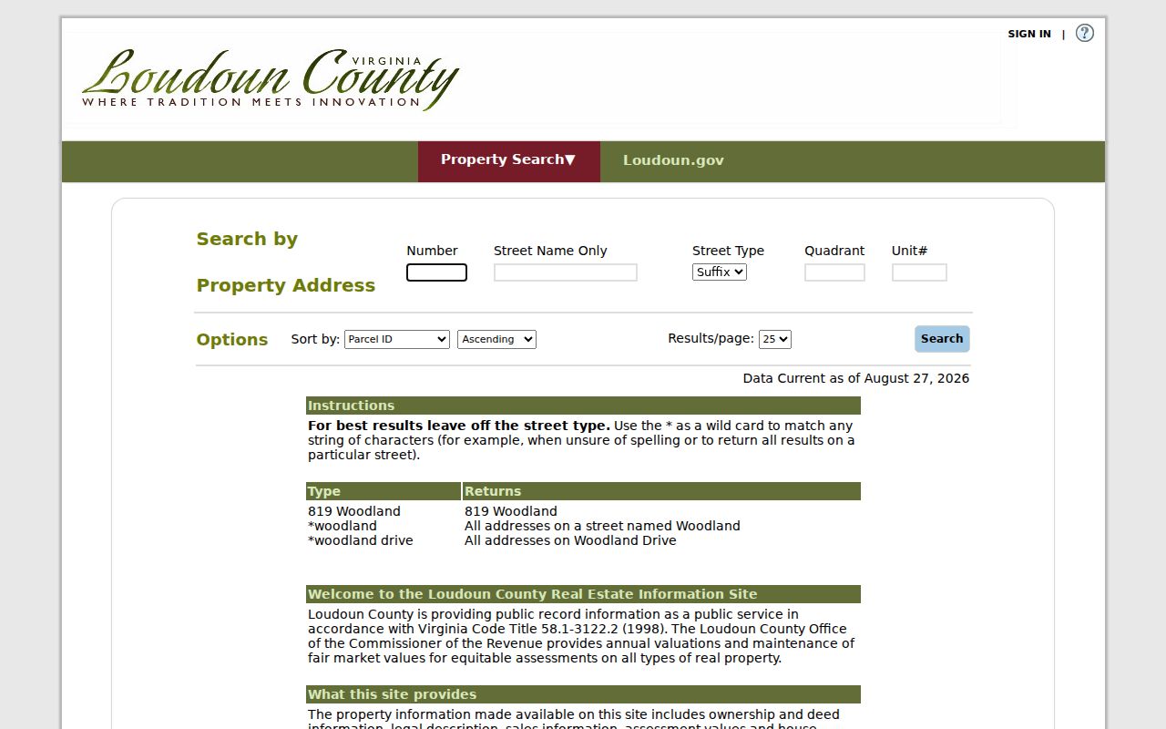
The Loudoun property address search has separate fields for the components people often run together. They are optional, which makes it useful to begin with a number and street name when a suffix or unit is uncertain. The public real-property search also accepts a PIN, land-use code, street number, street, ZIP Code, and a deactivated-accounts filter. PINs are 12 characters, and dashes may be entered or left out.
| Assessor field | How it works | Useful Ashburn street detail |
|---|---|---|
| Number | Optional text field | Use for a single known address; leave blank when inspecting a road name. |
| Street Name | Optional text field with wildcard support | Enter a partial or full name; omit the suffix first when the form varies. |
| Street Type and Quadrant | Optional dropdown controls | Use after a broad result needs narrowing to the county’s displayed road form. |
| Unit # | Optional text field | Separates a unit result from a larger parcel or multi-unit address. |
| PIN | Optional 12-character identifier | Bridges the assessment result to mapping, plats, and land-record research. |
| ZIP Code and Deactivated Accounts | Optional real-property controls | Refine a parcel search without assuming the ZIP defines county or CDP boundaries. |
The assessor’s live page is the best place to confirm its current prompts and data line before relying on a result.
The county’s address-search screen shows the number, road-name, type, quadrant, unit, sorting, and results-per-page controls used for an Ashburn street directory search.
Keeping each field separate helps distinguish a road name from its directional or unit detail before moving to another record system.
Wildcards for Ashburn Street Names
Road-name variants are common enough that Loudoun documents a practical wildcard method. An entry of *woodland can return roads named Woodland, while *woodland drive narrows the result to that form. When the suffix is unknown, leave it out first, compare the returned county street forms, and then add the type or quadrant only when needed. Do not convert a broad result into a list of people. It is only a set of parcel leads that still needs address-by-address verification.
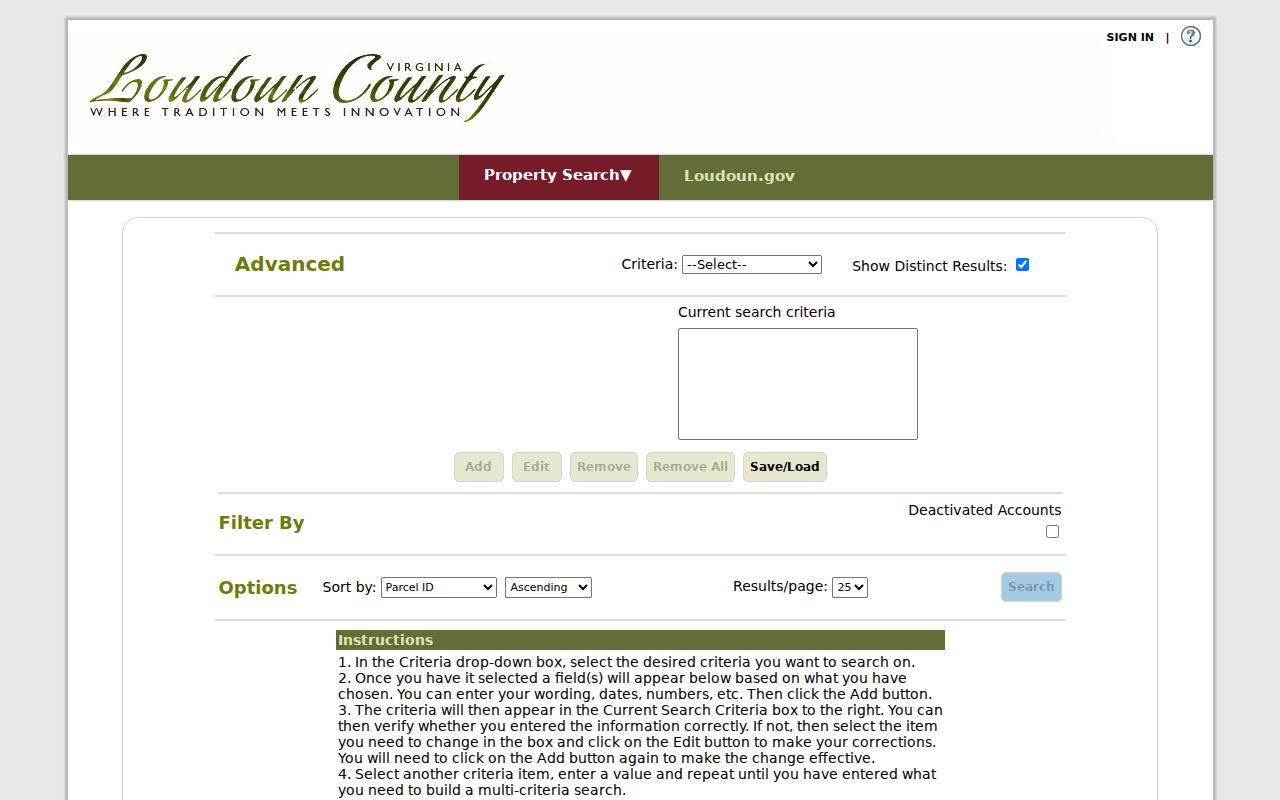
Advanced Search has its own criteria builder. Choose a criterion, provide the requested value, date, or number, and use Add; one criterion is required even though individual field options are not. The same screen offers Show Distinct Results plus Edit and Remove controls. Year-built, tax-map, and similar range questions belong there rather than in the basic address form.
The advanced assessor search documents the criteria workflow and wildcard instruction behind a broader Ashburn street directory query.
Use results as a starting set, then preserve the PIN and address form selected for each parcel rather than mixing near matches.
Note: Record the search date because the assessment portal reports weekly updates and a later screen can differ from an earlier result.
Map an Ashburn Street in WebLogis
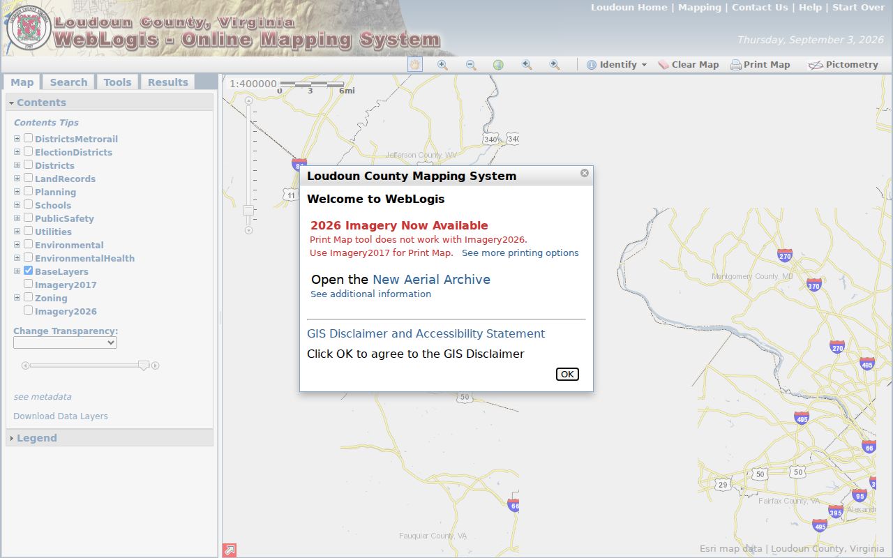
WebLogis is Loudoun’s map layer for testing whether an address, parcel, and road line refer to the same Ashburn place. Type an address, select the autocomplete suggestion, and then choose Locate on Map. The research notes that pressing Enter before selecting a suggestion can cause an error. A full or partial PIN, or a map tile, can also reach a parcel. Core parcel, address, and road data are updated daily from the prior business day.
The layer selector can show land records, ZIP codes, addresses, roads, subdivisions, zoning, districts, schools, environmental material, safety information, utilities, planning, and imagery. The viewer can also identify a parcel, show parcel and adjoiners, find adjoining parcels, and find parcels within a distance. These map tools are useful for geography, but a map boundary is not a survey and needs the viewer’s update date beside it.
The WebLogis parcel viewer combines address autocomplete, PIN tools, map layers, and the Locate on Map control.
After a street result is selected, turn on only the layers needed for the question so a ZIP or school boundary is not mistaken for a parcel line.
Ashburn Street Records by Address
Address-keyed sources have different purposes and access routes. The assessment and GIS systems offer current parcel context. The Circuit Clerk records transfers and plats. Building records may add project or issue dates. Virginia voter information has its own statutory limits and does not become a full household roll because a street is known. The PIN and legal description are the most useful links across the property-oriented sources.
| Address record | Keeper | Street-level result | Access route |
|---|---|---|---|
| Assessment parcel | Commissioner of the Revenue | Recorded owner or taxpayer, mailing and situs addresses, parcel details, assessment characteristics | iasWorld address, PIN, tax-map, or ZIP search; weekly update |
| GIS parcel | Mapping & Geographic Information | Parcel geometry, road, ZIP, zoning, subdivision, flood, school, and election layers | WebLogis web viewer or public office computers; core layers update daily |
| Deed and plat | Circuit Clerk | Grantor, grantee, transfer reference, legal description, lot, block, and plat clues | Courthouse terminals, remote land-record service, mail, email, or counter request |
| Permit record | Building & Development | Address, PIN, permit number, issue date, unit, project, or subdivision context | LandMARC, permit inquiry, and issued reports from 2015 |
| Voter record | General Registrar | Allowed registered-voter fields and election district information | Lawful public inspection under Virginia Code § 24.2-444 |
County records support ownership and property research, but the same result cannot prove who is present at an address today. A voter record can corroborate only the fields Virginia makes available, and it may be unavailable or protected. The historical directory shelf is a different source type, so it should be used as a dated finding aid rather than substituted for a current parcel result.
Ashburn Street PIN and Plat Terms
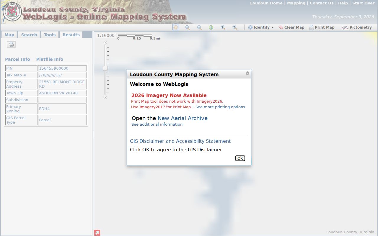
Street labels can change in spelling, postal usage, or subdivision context. The county’s parcel identifiers and recorded descriptions give an Ashburn street directory search a second reference point. WebLogis parcel information can display the PIN, tax map, property address, Town ZIP, subdivision, zoning, plat number, plat title, project number, and parent fields. Read those fields together before connecting one lot to another.
- Parcel
- A mapped unit of land in the county assessment system, normally tied to a PIN and assessment record.
- Situs address
- The physical property address used to locate the parcel. It is different from a mailing address for owner or taxpayer correspondence.
- Plat
- A recorded map that can show a subdivision, lot, block, street, easement, or parent-and-child parcel relationship.
- Criss-cross directory
- A historical directory arranged by address rather than name, useful as a dated lead when a volume and its coverage are confirmed.
The WebLogis parcel-and-plat view illustrates the fields that join a street address to county mapping and recorded-plat context.
A PIN or plat reference is a durable research lead, not a substitute for reading the underlying recorded document.
Ashburn Street Permit Records
For development context, Loudoun Building & Development uses LandMARC for permits, plans, applications, inspections, and related workflow. Issued building-permit reports supply another public route, with archived reports reaching back to 2015 and monthly PDF and Excel reporting from July 2023. An address, PIN, project, subdivision, or permit number can help reconcile a road address with a construction record.
If a LandMARC result is incomplete, check the county’s issued reports and use the permit-inquiry route for a specific matter. The inquiry form asks for a property address and can take a permit number; it says the primary inquiry should name one property address and one permit number, with a multiple-properties option when needed. A permit entry documents an administrative record. It does not identify a present household.
Note: Preserve the permit number, issue month or year, and PIN together, because project names and street labels alone can be ambiguous.
Ashburn Street Deed Records Since 1757
Loudoun’s Circuit Clerk maintains land records from 1757 to the present for public research at courthouse terminals. The available records include deeds, deeds of trust, judgments, assignments, certificates of satisfaction, and subdivision plats. For an Ashburn address, begin with the present PIN and legal description, then search the current recorded name and follow the prior instrument reference. A seller in one transfer may be the earlier grantee in the next link of the chain.
The access model has several paths. Courthouse kiosk viewing is free during the stated weekday hours. Remote occasional users can search the index without charge and buy an image individually. An approved annual remote subscription is listed at $262 for unlimited index and image viewing and downloading. Mail and email requests remain available when the document reference, page count, size, certification choice, payment, and return details are known.
The official Loudoun deed-index page lists six historical series from 1757 through 1903 and also links a partially proven wills-and-deeds index and a plat-reference index.
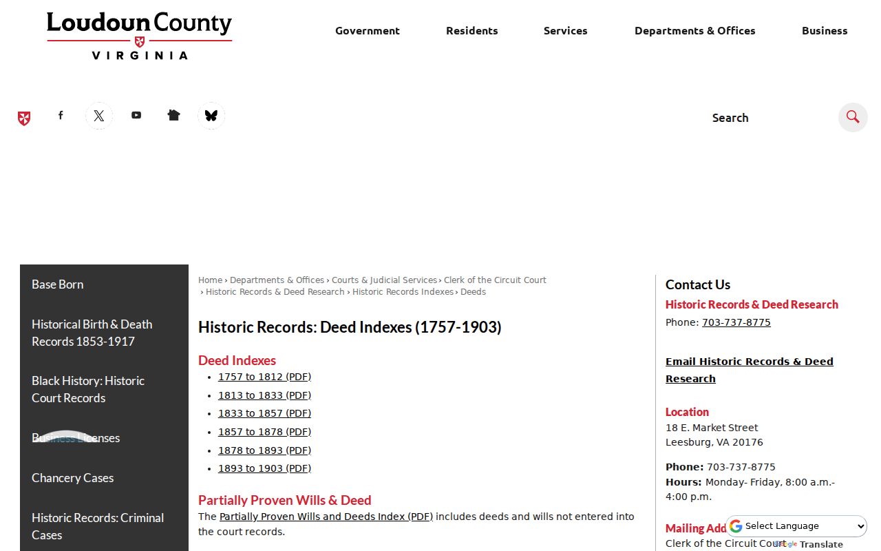
The date ranges are index guides. They point to the book, page, instrument, grantor, grantee, or plat reference needed for the next request.
The Loudoun remote land-records service displays the occasional-user, annual, and exempt access choices that supplement the courthouse terminals.
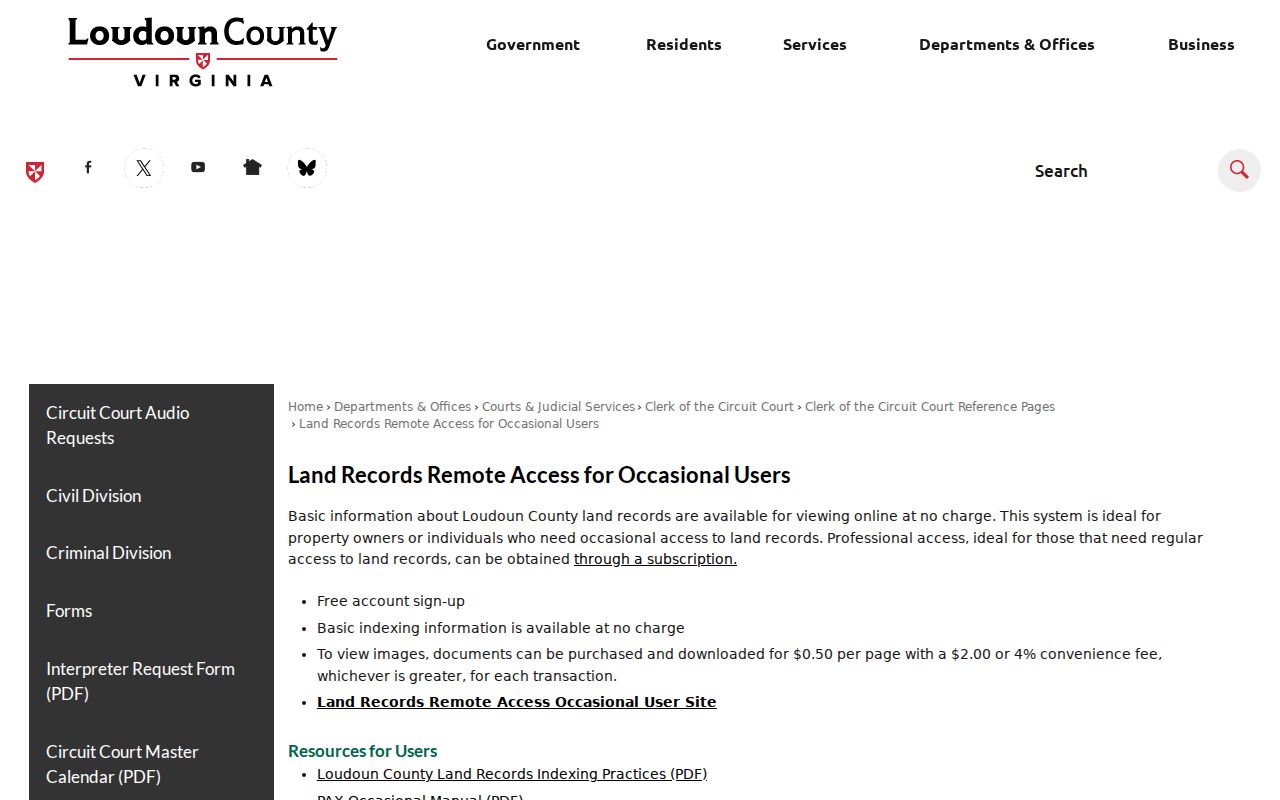
Index access, a document image, and a certified copy are separate levels of access, so keep the document reference with any copy request.
2001 Fire and Ashburn Street Records
The 2001 courthouse-complex fire is a useful provenance note, not a reason to assume Loudoun’s historic court material disappeared. County history says the historical court records were not destroyed. That matters when an older street or farm reference is being followed through deeds, wills, land tax, or court material. Access conditions, conservation work, and catalog notes may have changed, but the research does not support treating the fire as a break in the county’s long record chain.
Loudoun’s 1757 formation also matters for old address work. Post-formation court records belong in Loudoun research, while an older clue can still point toward Fairfax-related material. A modern PIN should not be projected backward by itself. Use recorded plats, legal descriptions, tax-map clues, old maps, and the deed chain to bridge a present Ashburn street address to earlier geography.
Ashburn Street Postal Context
County address geography and postal geography overlap but are not the same. A WebLogis parcel can show a Town ZIP, while the U.S. Postal Service controls the delivery address and may normalize a result to a ZIP+4 or another city label. Loudoun’s mapping office assigns addresses and approves street names for county systems. Ashburn itself is a Census-Designated Place in Loudoun County, not an incorporated town with a separate address department.
Use the parcel boundary, PIN, and legal description when a mailing line does not match the expected Ashburn label. Postal changes can make an older deed-index clue look different from a current delivery line without changing the parcel. For a ZIP-by-ZIP method, the Ashburn ZIP code directory explains the documented postal set and the historical 20148 realignment.
Note: A postal result is a delivery reference, not evidence that a person currently lives at the matching address.
Ashburn Street Voter Record Limits
Virginia Code § 24.2-444 permits public inspection of specified registration-list fields, including name, address, year of birth, gender, and applicable election districts. The Virginia Citizen Portal is different: it is a self-service tool for a person checking their own registration, polling place, districts, absentee status, or voting history. Do not use another person’s identifying information to enter that flow.
The public list excludes Social Security information, day and month of birth, registration-agency details, declination-to-register data, and certain protected or permitted mailing addresses. It cannot establish every person at a property or show how anyone voted. For an allowed inspection question, ask the Loudoun Office of Elections about the current procedure instead of assuming a street-wide download is available.
Limits of an Ashburn Street Directory
An Ashburn street directory can assemble public property and record clues, but it cannot supply a complete household roster. Recorded owner or taxpayer information is not proof of present occupancy. A plat shows land relationships, not personal relationships. Permit and deed results have their own dates and purposes. Utility customers, private membership rosters, school-student data, protected addresses, and DMV personal information are not general street-search sources.
Virginia’s Address Confidentiality Program protects the actual location of eligible participants through a substitute address and mail-forwarding arrangement. Court files may also be sealed or restricted, and voter data has specific exclusions. When a record has a redaction or confidentiality limit, keep that limit intact. A missing result may reflect the source’s scope, a protected record, or a different address format.
Lawful use. Use Ashburn street and parcel records for lawful personal, family-history, estate, civic, or property research. Do not use a name or address result to stalk, harass, intimidate, or harm anyone.