
Ashburn ZIP Code Coverage
Ashburn’s practical postal set has four ZIP codes: 20146, 20147, 20148, and 20149. The available USPS material groups 20146 through 20148 with Ashburn. The inspected research did not retrieve a public USPS result that settles the current delivery type or exact scope for 20149, so that row stays qualified rather than guessing. Each ZIP is a delivery geography. It is not a town line, parcel boundary, or proof that a location is inside the Ashburn CDP.
| ZIP | Areas | Post Office | Notes |
|---|---|---|---|
| 20146 | Ashburn postal area | Ashburn postal processing association | Verify the individual street with USPS; the ZIP is not a city or CDP boundary. |
| 20147 | Central and eastern Ashburn postal area; common Ashburn addresses | Ashburn | USPS postal material groups 20146–20148 with Ashburn; validate the delivery line by address. |
| 20148 | Ashburn, Moorefield, and newer development areas | Ashburn | WebLogis samples show Ashburn VA 20148; 71 deliveries moved here from 20175 in 2008. |
| 20149 | Associated with the Ashburn postal city | Ashburn association to verify | Exact residential, PO-box, or unique-delivery scope was not verified in the inspected official result. |
Parts of Loudoun use postal place names such as Leesburg, Sterling, Dulles, Chantilly, or Herndon. An “Ashburn, VA” line does not prove CDP membership, and an Ashburn CDP parcel can use a neighboring postal label. Use the postal result for delivery and the county parcel or map record for local geography.
Verify Ashburn ZIP Codes With USPS
The USPS ZIP Lookup offers three separate paths: find a ZIP by address, find ZIPs by city and state, or find cities by ZIP. The address path accepts company information when relevant, street address, apartment or suite information, city, state, and a ZIP if known. Use the complete delivery address when the task is to confirm the postal line, especially where a subdivision name and a county address may suggest different labels.
USPS warns that a ZIP result does not confirm a person or company is at the address. It is a delivery match only. The USPS Address Information System Viewer is the authoritative current ZIP-data product for address management and is updated monthly, but its encrypted data cannot be exported from the viewer. Treat each tool as a postal check, then move to county records for parcel details.
Note: Save the exact address submitted and the date of the USPS result when reconciling a deed, letter, or map with a newer postal line.
2008 Ashburn ZIP Code Realignment
Postal history can explain an apparent mismatch without proving a move. Effective November 19, 2008, a USPS Postal Bulletin realignment directed 71 deliveries that had used 20175 Leesburg to use Ashburn VA 20148. A record created before that date may therefore carry 20175, while the same parcel’s current delivery line uses 20148. The published change concerns postal administration, not a transfer of land or a change in county jurisdiction.
For a historical address question, compare the date, road, parcel, deed, tax map, and older postal evidence. A ZIP string by itself is weak evidence. The reliable bridge is the parcel PIN or legal description, followed by the associated recorded documents. This small postal change is especially useful when a former address seems to disappear from a modern ZIP search.
Ashburn ZIP Code Fields in iasWorld
The Loudoun Real Estate Tax, Assessment & Parcel Database accepts ZIP Code as one of several real-property search fields. It is a parcel tool, not a resident list. Results can show public property information such as recorded owner or taxpayer information, mailing and situs addresses, legal description, deed and sales information, assessments, and physical characteristics. The database states that it is updated weekly, and the live screen supplies the current data line.
| Real-property field | Use in an Ashburn ZIP code search | Important limit |
|---|---|---|
| ZIP Code | Limits a broader parcel query to the selected postal area. | Returns property records, not a list of people within that ZIP. |
| Street and Street # | Combines a ZIP with a road or address number for a narrower parcel set. | Use the county’s stored street form and compare results address by address. |
| Parcel ID / PIN | Connects a known parcel to assessment and map information. | PINs are 12 characters; a PIN is more stable than a postal label. |
| Land Use Code | Refines a property question within the chosen ZIP. | It describes county land use, not current presence at a location. |
| Deactivated Accounts | Includes or excludes the portal’s deactivated-account results. | Review a returned record’s status and date before drawing conclusions. |
The real-property search screen displays the PIN, land-use, street, ZIP, and deactivated-account controls documented for an Ashburn ZIP code directory search.
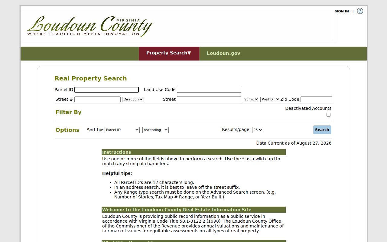
Use ZIP as one filter among several, then preserve the PIN and legal description attached to every parcel that needs follow-up.
Find Residents in an Ashburn ZIP Code
A ZIP-first approach is most reliable when it narrows a property question before a street or parcel review. Confirm the delivery address with USPS, then use the same ZIP in iasWorld. WebLogis can display a ZIP Codes layer beside parcel boundaries, roads, subdivisions, election districts, schools, and census geography. Once a parcel is identified, use its PIN and street address to reach more precise property or recorded-document information.
- Check the complete delivery address in USPS ZIP Lookup and record the returned ZIP or ZIP+4 as a postal reference.
- Enter the ZIP Code in iasWorld with a street, number, PIN, or land-use field when the parcel question needs narrowing.
- Open a selected parcel in WebLogis and compare the Town ZIP with the parcel boundary, subdivision, road centerline, and any needed district layer.
- Use the PIN, legal description, or recorded name for a specific deed, plat, permit, or other county record question.
- Ask the elections office about lawful public-inspection procedures when voter information is relevant; the Citizen Portal is for a voter’s own record.
A ZIP-wide parcel set still needs a street-level check. The Ashburn street directory follows the address, PIN, plat, deed, and permit chain after a ZIP has narrowed the search.
WebLogis Layers for Ashburn ZIP Codes
WebLogis lets a user turn on ZIP Codes alongside addresses, roads, parcels, subdivisions, zoning, school boundaries, election districts, environmental layers, planning layers, and imagery. Enter an address, select the autocomplete suggestion, and then use Locate on Map. Do not press Enter before choosing the suggestion, because the documented workflow warns that this can produce an error. A full or partial PIN or a map tile can also locate a parcel.
The parcel popup can show PIN, tax map, property address, Town ZIP, subdivision, primary zoning, parcel type, plat number, plat title, project number, and parent fields. Core parcel, address, and road layers are updated daily from the prior business day. This makes the viewer a useful comparison surface, but it does not replace USPS validation or a recorded plat.
The county map viewer shows the address, parcel, PIN, and layer controls used to compare Ashburn ZIP code geography with county records.
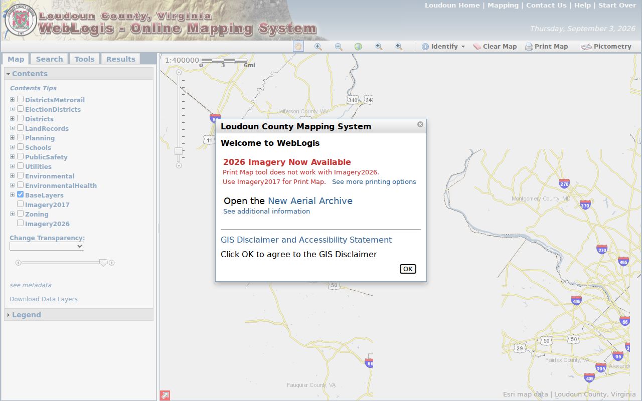
Zooming to a parcel and switching on the ZIP layer makes the relationship visible, but it does not make the ZIP edge a legal property boundary.
The WebLogis parcel popup shows the county fields, including Town ZIP, that should be read beside the parcel and plat information.
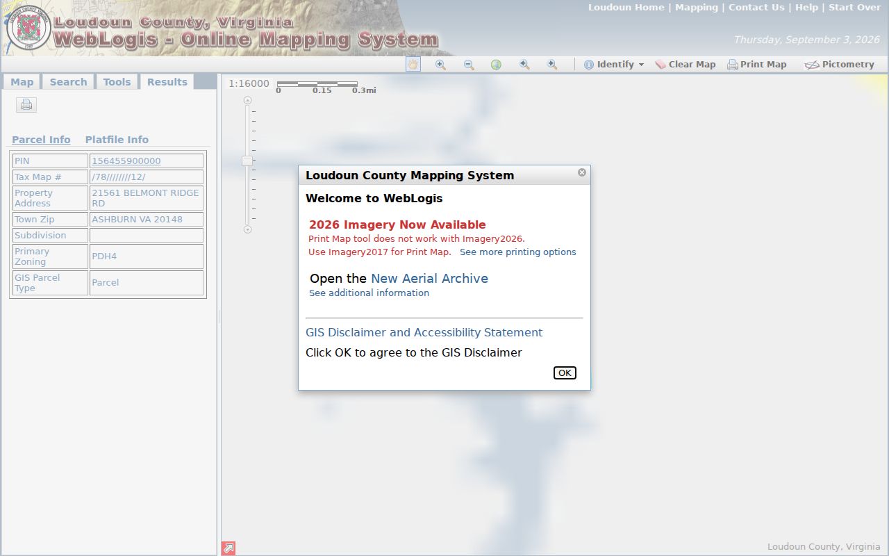
A Town ZIP on a county parcel screen is a geographic clue. It does not incorporate the parcel into a town or establish a resident’s location.
Ashburn ZIP Code Permit Context
County permit material adds development context to a ZIP-filtered parcel search. Loudoun’s residential permit GIS layer includes PIN, permit number, month and year, address, unit type, census block, election district, project or subdivision, planning subarea, policy area, Metrorail district, noise zone, ZIP Code Area, and ZIP. LandMARC and issued reports can be searched by address, PIN, or project. The research did not document a public ZIP filter in LandMARC, so do not assume one exists.
Issued building-permit reports have archived material from 2015, while reports have been split into monthly PDF and Excel files from July 2023. When a portal result fails, compare the address or PIN with the issued reports and use the county permit-inquiry path for a specific record. A permit can establish a county action at a location and date; it does not establish who is presently there.
Note: Keep the permit number, address, PIN, project, and ZIP field together because any one of those references can change or be incomplete alone.
Ashburn ZIP Codes and CDP Lines
Ashburn is a Census-Designated Place in Loudoun County, not an incorporated town. Its postal labels do not define a legal local jurisdiction. A parcel in the CDP can use a neighboring postal city or ZIP, and an address labeled Ashburn can sit outside the CDP boundary. Use WebLogis to compare the parcel with ZIP, census, and administrative layers. For an official delivery line, return to USPS; for an address assignment question, Loudoun’s Mapping and Geographic Information office is the county authority.
- ZIP code
- A postal delivery geography used to sort mail. It does not define a city, CDP, parcel, or election district.
- ZIP+4
- An added four-digit postal segment that refines delivery within a ZIP. USPS may normalize an address to this fuller form.
- PO-box ZIP
- A ZIP used for post-office boxes. The available research does not verify whether any Ashburn ZIP has this delivery type.
- Unique ZIP
- A ZIP assigned to one organization or destination. The available research does not verify one for Ashburn.
- Carrier route
- A mail-delivery grouping within postal operations. It is not a substitute for a parcel or jurisdiction boundary.
Situs is the physical parcel address. A mailing address is where an owner or taxpayer receives correspondence, and a legal description identifies the land by lot, block, metes-and-bounds, parent parcel, or plat reference. These three labels can differ, so none should be used as a shortcut for the others.
Voter Records and Ashburn ZIP Codes
A ZIP is not a voter-file filter described for the Virginia Citizen Portal. That portal is for a person checking their own registration, polling place, election districts, absentee status, or voting history and requires personal identifying information. The dedicated polling-place lookup uses a full address including ZIP, but its result is voting-place information, not a public list of people within a ZIP.
Virginia Code § 24.2-444 controls inspection of voter registration lists. The law identifies public fields and excludes Social Security information, day and month of birth, registration-agency identity, declination information, and certain protected or permitted mailing addresses. The Loudoun Office of Elections can explain the current lawful process. A missing or different voter result does not establish that a person left a ZIP area.
Limits of the Ashburn ZIP Code Directory
The Ashburn ZIP code directory can organize a postal question and point toward county records, but it cannot prove residence, ownership, CDP membership, or a complete household at an address. USPS expressly says its ZIP result does not confirm that a person or company is present. Assessment records show a recorded property relationship and may show different situs and mailing addresses. Maps show layers maintained on different schedules.
Virginia voter records, court files, and protected addresses have their own disclosure limits. The Virginia Address Confidentiality Program uses a substitute address for eligible participants, and the actual physical address remains confidential for ordinary purposes. Do not try to infer a protected location from postal, parcel, voter, DMV, or court data. When source systems disagree, note the date, check the responsible custodian, and leave the protected limit in place.
Use ZIP results carefully. Use Ashburn postal and parcel sources for lawful personal, family-history, estate, civic, or property research. Do not use an address or ZIP result to stalk, harass, intimidate, or harm anyone.